Home
Current wildfires
Historical wildfires
The data
About the authors
Home
Current wildfires
Historical wildfires
The data
About the authors
The Data Used in the Project
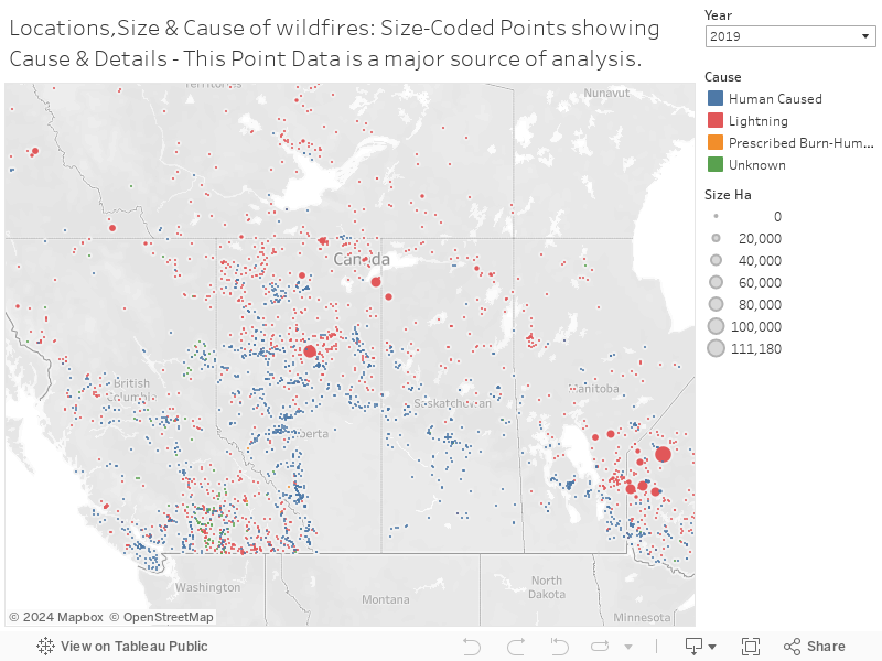
Wildfire pointdata that are a basis of the historical analysis
The analysis of wildfires is based on the wildfire points shown below. These points are extracted from the National Fire Database fire data, which is available in the form of polygon data and tabular point data. Since not all fires are represented in the shapefile, we have chosen to use the tabular point data as a basis for the exploration of various aspects of wildfires.
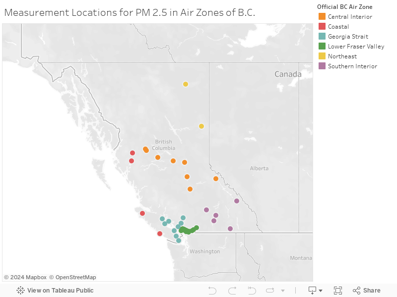
Stations for Measurement of PM 2.5
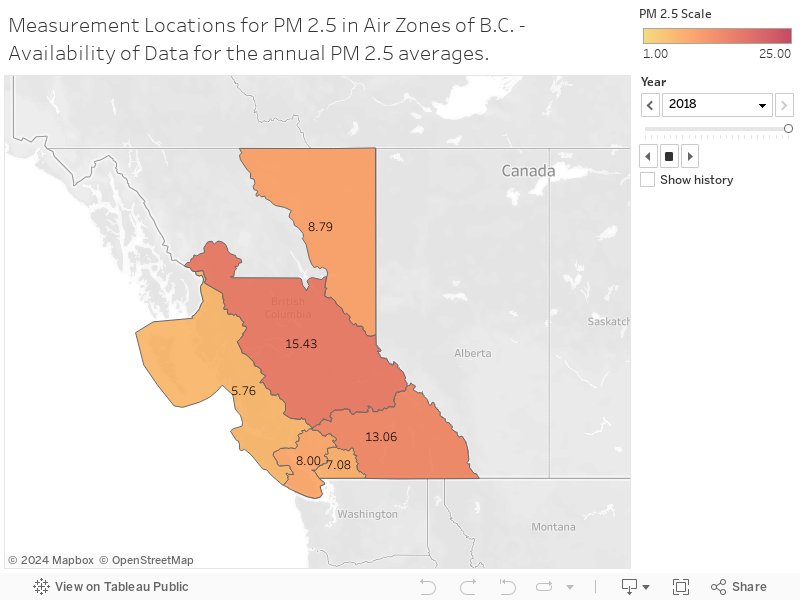
British Columbia is divided into air zones, each with multiple stations that measure PM 2.5 levels. The stations and air zones for which data is available and that were used in our project are plotted below.
To view the availability of data over the years for air zones of British Columbia, please use the play forward button. By doing so, you will be able to observe the different zones for which data were reported over the years.
data sources
Data was collected and aggregated from the various sources, as listed below.
BC Data Catalogue
Canadian Forest Service. 2020. National Fire Database - Agency FireData. Natural Resources Canada, Canadian Forest Service, Northern Forestry Centre, Edmonton, Alberta.
National Air Pollution Surveillance Program. 2020. Available from the Government of Canada Open Data Portal at open.canada.ca.
Canadian Council of Forest Ministers - Conseil canadien des ministres des forêts. 2020. National Forestry Database - Base de données nationales des forêts - Canada (Version 2.0.0) [Data set]. Natural Resources Canada – Ressources naturelles Canada
Adjusted and Homogenized Canadian Climate Data (AHCCD). 2020. Available from the Government of Canada Open Data Portal at open.canada.ca.
Smartfire 2.0